


The next gen in motorcycle GPS
I like maps. Everyone who knows me knows I am a map guy. I collect them, pile them up, hoard them like a pirate and spread multiple states out on the floor for trip planning then bundle them back up before they get stabbed. Yes, stabbed. Don’t ask.
It would take a lot to convince me to ditch the maps, go digital and add yet one more thing to the cluttered dash of my bike, until Garmin sent me their newest motorcycle focused GPS system, the Zumo XT3 motorcycle specific navigator, abounding with features like smartphone connection, trip planning, lean angle sensor, group ride tracking and drag race timer. Drag times? Hmmm…
Installation was as simple as clamping it to my stem mounted Ram mount, then connecting wiring to my FZ1 fuzeblock. Wiring tucked away makes for a clean, neat, stable mount. Connecting to my iPhone meant installing the Tread app, scanning a QR code and following the prompts to link the two.
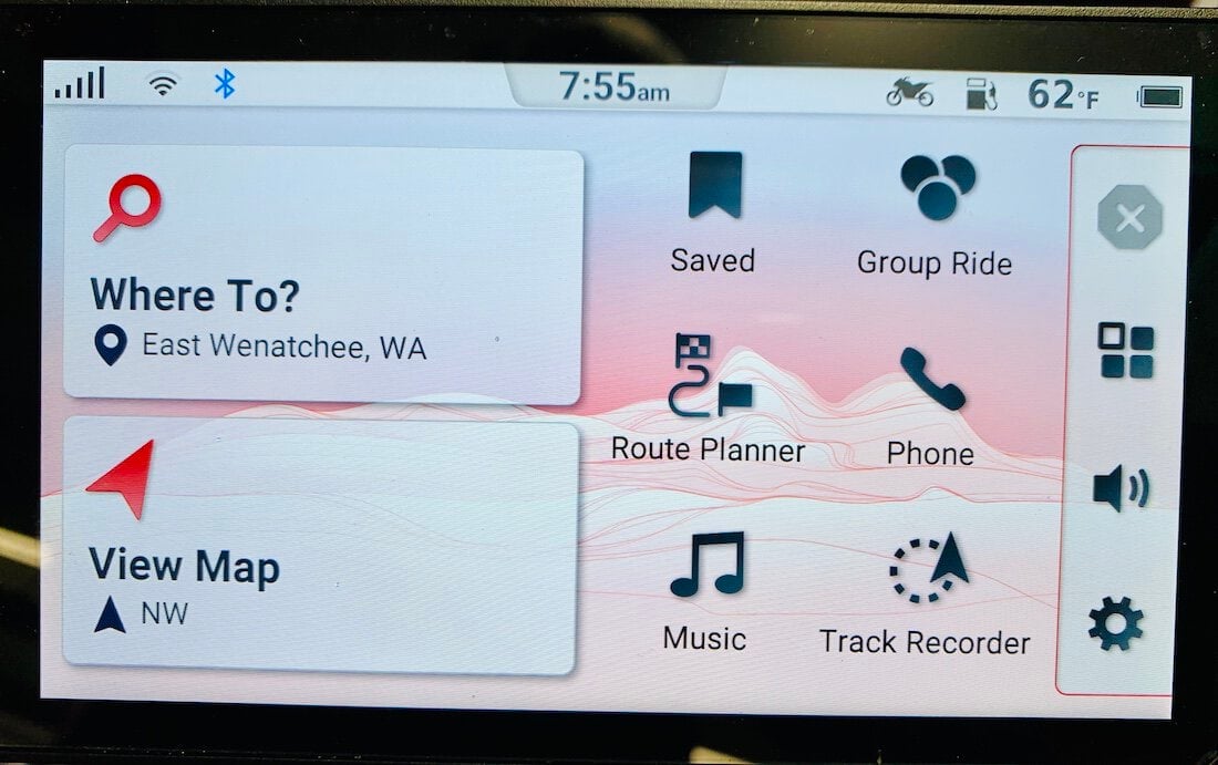
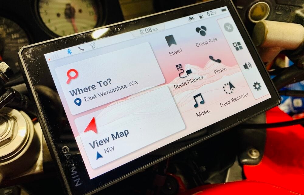
I was impressed with the brightness of the display. It worked with gloved fingers first time, every time. Each of the icons on the screen takes you to a menu that responds when touched. From the temperature icon which takes you to the weather, to the music icon which allows you to control music from your phone, all the controls are intuitive.
For the test I went in with both feet, put away my maps and used the Tread app on my laptop to plan a four day tour of Washington and Canada. Like any new piece of software, there is a bit of a learning curve, but overall, plotting routes was as simple as clicking on a departure point, an end point, then waypoints along the route. What impressed me is that since my Mac, iPhone and GPS all play in the same sandbox, any trip planned on my laptop automatically synched to my phone and GPS without any additional buttons to click.
This is where the XT3 started to win me over.
Our group was arriving at our cabin from different points which meant endless text messages back and forth to coordinate arrival points and times. Since my iPhone was connected to the XT3, each text message would appear in the far right corner of the screen as I rode. Simple communication like this can be a massive time saver on group rides.
This new Garmin was growing on me.
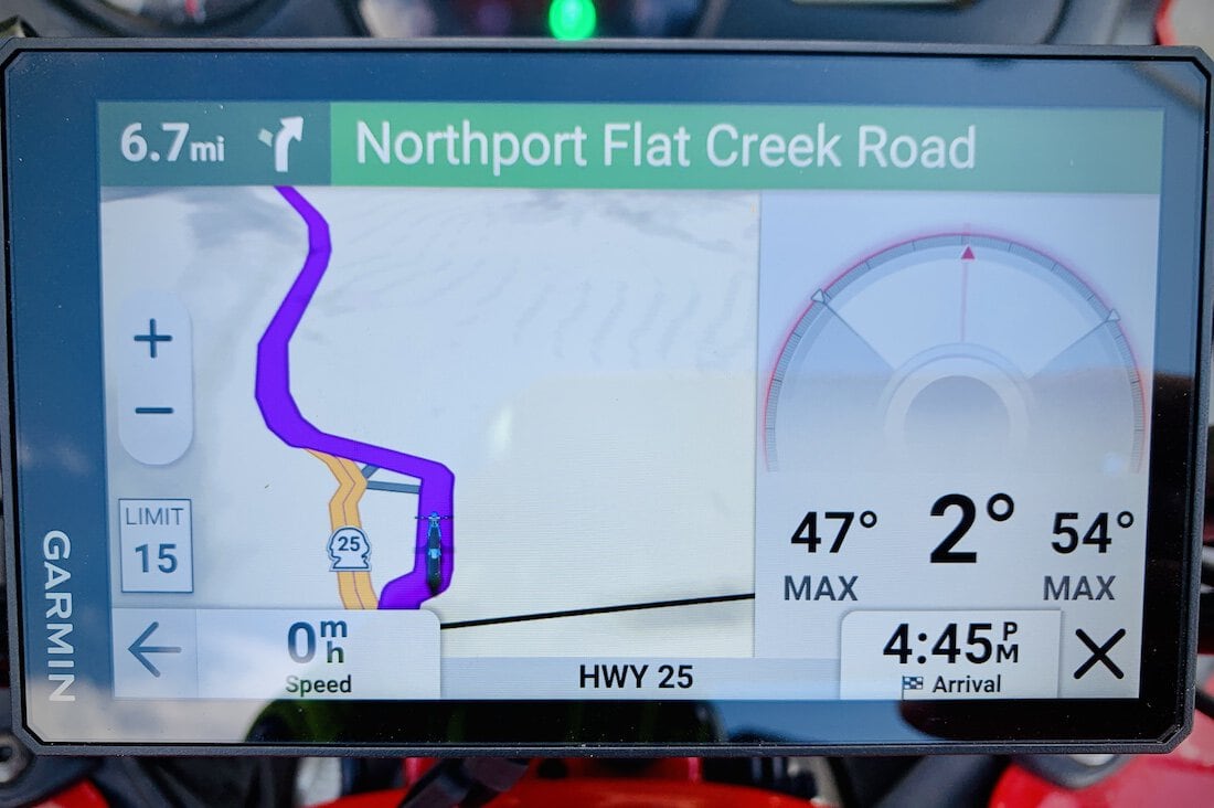
All displays to the right of the map are customizable to show everything from arrival time, distance to destination and more. Lean angle sensor is entertaining and should not be treated as a video game where you try to set the high score. Nope. Not at all. No sir.
I had our next day’s route planned to take us into Canada just to see what the XT3 would do. It didn’t miss a beat. Not only does the Garmin tell you the speed limit for the road your are on, but once in Canada it keeps the display in miles per hour. If you are on a road that says 70 kph, the Garmin will show a small speed limit sign of 43 mph allowing you to use your bike’s speedometer as you usually would, which may or may not have saved me from running afoul of a certain Royal Canadian Mounted Police in a stealth black truck by the side of the road. The Garmin just paid for itself.
While riding, all screen prompts are big, easy to find and respond to gloved fingers the first time, every time. The display is always bright enough to read, even when the sun is behind you and shining directly on the unit. I was impressed with the quick response time of prompts and how easy it was to navigate menus with gloves. While the main screen shows your location on a map, the side bar can display a wide range of information from the song playing on your phone, lean angle sensor, what time you will arrive at your destination and more.
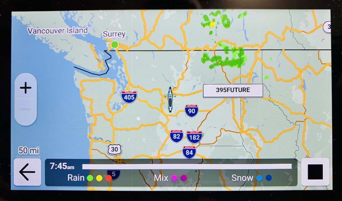
Real-time weather data is a game changer for making quick trip changes. This is where the Garmin starts to make sense and the depth of its capabilities won me over.
A more thorough test than just a four day trip was needed, so I took the Garmin on a seven day tour of the Pacific Northwest where the GPS proved itself indispensable in unusual ways. I had already gotten used to using it for trip planning, finding gas stops in remote areas and finding coffee shops, but I started to use it in unintended ways. For example, like a co-driver in a rally car.
When going full tilt on a snaking bit of unfamiliar road with many blind curves, I would glance down at the GPS, see the road ahead and call out curves through our Cardo communicators to the lead rider. I would say “hairpin right, decreasing radius degree left” so the lead rider would not be caught off guard. Also, on many winding Pacific Northwest mountain roads, passing spots are rare. I could tell the lead rider to be patient, that a straight stretch of road was coming up in a half mile. I doubt this is what Garmin had in mind when creating the Zumo XT3, but this use for safety’s sake sold me on this new piece of tech for group touring. Add to this the number of times the Garmin saved us from wrong turns, navigated us through vulgar city traffic snarls and helped us make giant 100 mile u-turns around closed roads and I will not tour again without the XT3.
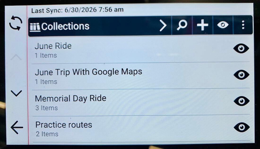
Trips saved in the Tread app are organized into collections for easy recall and use at any time. Ever have one of those routes where you always question which turn to take? Create a route and save it for future use.
The Garmin XT3 will do so many more things than I tested here. It will track other riders in your group so you can see their live location, adjust your route with a slider to create more or less twisty routes and while it will not have a taco truck drop shipped to your arrival point (come on Garmin, you can do this) it can help you find one already parked there. But if you are reading this, you are probably trying to decide if the new Garmin XT3 is right for you and if it is worth the $499.99 purchase price (they are currently on sale at their website for $399.99).
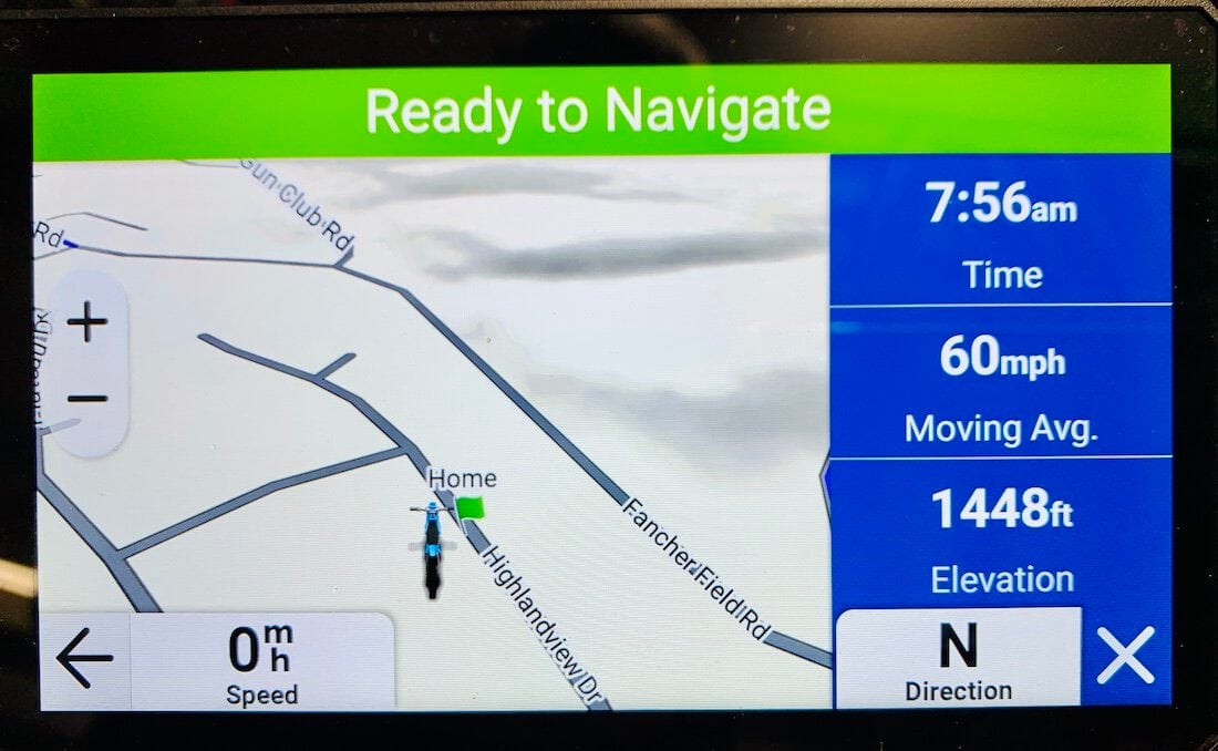
The Zumo XT3 does the simple things well and makes the complex easy. No matter your level of comfort with technology, the Zumo makes you feel comfortable exploring the depth of its features.
It is.
If you ever travel to unfamiliar places, it will pay for itself immediately. If you travel in a group where other riders do not have GPS or are using their phones as navigation devices, then buy the XT3. All it needs is a view of the sky and does not need cell towers for location or use cell data. If you plan trips for more than two days, have a motorbike that needs more frequent gas stops, or change plans spontaneously while you ride, then get the Garmin Zumo XT3. For sure at $499.99 it is a bit pricey, but so is getting lost, running out of gas, meeting that nice Royal Canadian Mounted Police officer, or not finding a place to spend the night.
The best testimony I can give is this: after 13 days and over 2,500 miles of touring and testing, the Garmin has earned a permanent place on the dash of my motorcycle. And while I still use my precious maps to dream, I use the Garmin to get me there.
Ted
*Please take a moment to visit our sponsors, both here below and above our articles. They ensure our content remains free for you.






















It’s been a few years, and I still don’t know what that poor map did to deserve a stabbing. Fun times!
As I was chasing along during that 7-day trip, I knew you were getting just the right amount of road information from the Garmin (passing lanes and such), and as soon as I dropped out of comms, I … didn’t. What a killer feature.
You had me on frequent gas stops… My Empty (MT)-10 is a thirsty girl.